Navaho & Earl Peaks
This Saturday Chris and I went on a long trailrunning adventure, up Navaho Peak and Earl Peak. This route was partially inspired by a nearby run group run Chris did with the 'cowgill trail collective'. They are a group of people who run in cow-themed shorts & sports bras. Often you see a large 'herd' [group] of 'cows' [trailrunners] 'grazing' [running] up the mountain! Many 'cows' are present on trail-running race podiums.
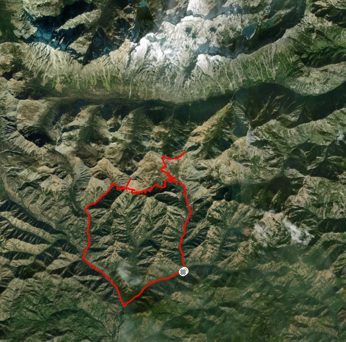
The run was 21.93 miles and 6,742ft of vertical gain, and took us 7 hours 12 minutes car-to-car. This route was well selected by Chris - the Teanaways are just south of the Mt. Stuart range, and just east of the Cascades. Those ranges form a rainshadow that blocks most snow in the winter, which is how these ~7000ft mountains have no snow on the summit, while Mt. Saint Helens has snow from 3000' to 8000'. It's also a fairly secret area (Navaho Peak is #80 on the alltrails top 100 WA list), compared to Colchuck Lake (#2 on the 'alltrails top 100 WA list') and the enchantments a few miles north. There are places to cut the route and exit early - a 13 mile option and a 18 mile option if necessary.
Chris's car was stuck in a malfunctioning condo garage, so we ended up leaving Seattle at about 8:30am, and got started at 10:56am. Temperatures were very good - 65℉ and dry. Still, I consumed 6 liters of water (we filled up my 1.5L container 3 times at various creeks with Chris's filter) and ate 1,800 calories of food. Fortunately the days are quite long now, and we were able to drive back to Seattle and pick up pizza before it got dark at 10pm!
Here was the route - first we went up the Stafford Creek Trail, then went on the Navaho Peak Trail on a short out & back to Navaho Peak. After that we took the Standup Creek Trail, onto the Bean Creek Trail, and did a short out&back on the Earl Peak Trail. Once we descended the Bean Creek Trail, we did about 6 miles of forest road to get back to the car.
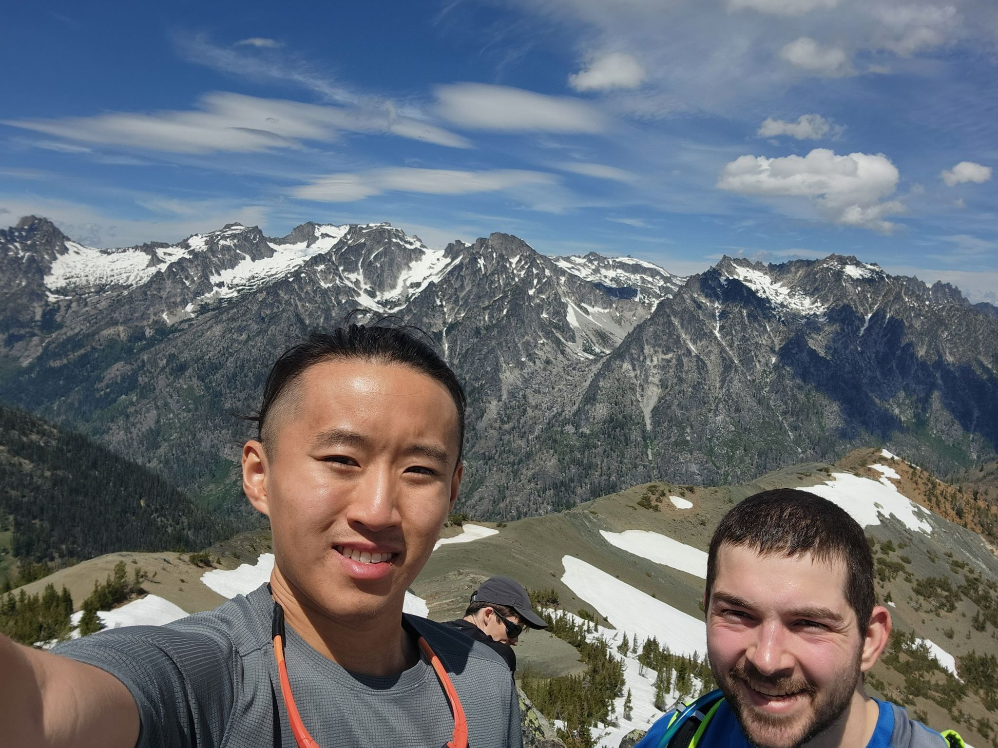
 This photo is from the top of Navaho Peak - there were 10-12 people up there! In the background, you can see Mt. Stuart Range. (the site of the enchantments-backdoor camping adventure a few years ago)
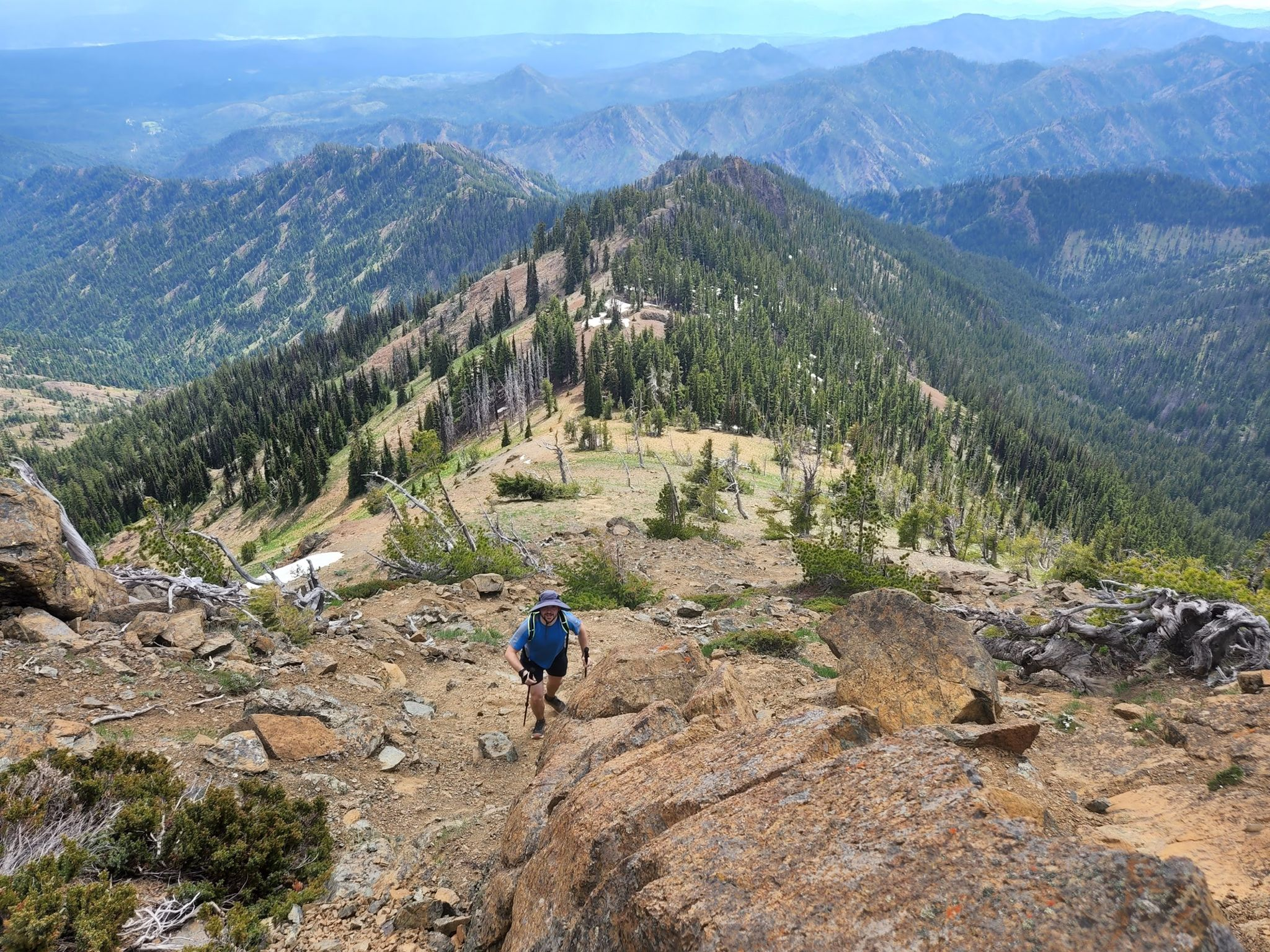
 Here is a photo of me slowly walking up Earl Peak. I started to get very tired fairly suddenly about ~5800 vertical feet in.
 There was no one except us on Earl Peak.
Somewhat entertainingly, we kept running into the same friendly older couple - they started at the Navaho Pass trailhead an hour before us, we passed them on the way to Navaho Pass. Then they made a left while we went up Navaho Peak, so we passed them a second time. Then they hiked past Earl Peak while we were up on Earl Peak, so we ran into them a third time. It was pretty funny. They told me they had set up a car-shuttle with two cars rather than go 6 miles on the forest road back to their campsite.
I was starting to get really tired as we went up Earl Peak. After walking downhill for a time, the air got thicker & I felt less exhausted and ran most of the last 10 miles to the car (fortunately, almost all downhill!). The next day, my leg muscles are sore, but everything seems to be working fine.
Until next time,
Peter
There was no one except us on Earl Peak.
Somewhat entertainingly, we kept running into the same friendly older couple - they started at the Navaho Pass trailhead an hour before us, we passed them on the way to Navaho Pass. Then they made a left while we went up Navaho Peak, so we passed them a second time. Then they hiked past Earl Peak while we were up on Earl Peak, so we ran into them a third time. It was pretty funny. They told me they had set up a car-shuttle with two cars rather than go 6 miles on the forest road back to their campsite.
I was starting to get really tired as we went up Earl Peak. After walking downhill for a time, the air got thicker & I felt less exhausted and ran most of the last 10 miles to the car (fortunately, almost all downhill!). The next day, my leg muscles are sore, but everything seems to be working fine.
Until next time,
Peter
This photo is from the top of Navaho Peak - there were 10-12 people up there! In the background, you can see Mt. Stuart Range. (the site of the enchantments-backdoor camping adventure a few years ago)
Here is a photo of me slowly walking up Earl Peak. I started to get very tired fairly suddenly about ~5800 vertical feet in.
There was no one except us on Earl Peak.
Somewhat entertainingly, we kept running into the same friendly older couple - they started at the Navaho Pass trailhead an hour before us, we passed them on the way to Navaho Pass. Then they made a left while we went up Navaho Peak, so we passed them a second time. Then they hiked past Earl Peak while we were up on Earl Peak, so we ran into them a third time. It was pretty funny. They told me they had set up a car-shuttle with two cars rather than go 6 miles on the forest road back to their campsite.
I was starting to get really tired as we went up Earl Peak. After walking downhill for a time, the air got thicker & I felt less exhausted and ran most of the last 10 miles to the car (fortunately, almost all downhill!). The next day, my leg muscles are sore, but everything seems to be working fine.
Until next time,
Peter